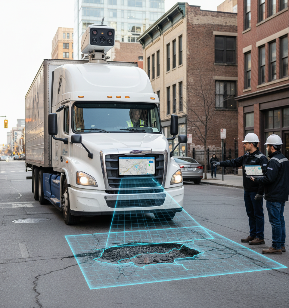
In a significant development for urban infrastructure management, Samsara, a prominent fleet management company, has introduced an artificial intelligence (AI) model designed to revolutionize pothole detection and assessment. This week, the company announced its new solution, which utilizes high-resolution cameras integrated into commercial vehicles to autonomously identify various types of road damage and precisely gauge their rate of deterioration. This technological leap offers municipalities a potent tool to more efficiently allocate resources and proactively address the substantial economic and safety challenges posed by crumbling road networks.
The Pothole Pandemic: A Global Economic Drain
Potholes are not merely an inconvenience; they represent a persistent and costly impediment to transportation infrastructure worldwide. Annually, these road imperfections cost drivers billions in vehicle repairs and inflict significant financial strain on municipal budgets tasked with their remediation. For instance, the American Automobile Association (AAA) estimated in 2021 that pothole damage costs U.S. drivers approximately $26.4 billion annually. Beyond direct repair costs, poorly maintained roads lead to increased fuel consumption, longer travel times, and elevated accident risks, all contributing to a diminished quality of life for urban residents. Traditional methods of pothole detection, often reliant on citizen reports or manual inspections, are notoriously inefficient, reactive, and incapable of providing the granular data needed for predictive maintenance.
Under the Hood: Samsara's AI-Driven Approach
Samsara's innovative system operates by deploying advanced AI algorithms to analyze continuous data streams from vehicle-mounted dash cameras. These cameras, already present in many commercial fleets for safety and telematics, are now repurposed to identify specific visual signatures of road damage, differentiating between minor cracks, moderate potholes, and severe surface failures. Crucially, the AI model doesn't just detect; it also assesses the size, depth, and estimated deterioration rate of each identified pothole.
This predictive capability allows city planners and maintenance crews to prioritize repairs based on urgency and potential impact, moving from reactive patching to a more strategic, data-driven maintenance schedule. The data collected is then geotagged and integrated into a real-time mapping interface, providing an actionable overview of road conditions across an entire city or region.
Shifting the Paradigm of Infrastructure Maintenance
The impact of this technology extends beyond mere identification. By providing precise, real-time data on road conditions, Samsara's AI model empowers cities to optimize their maintenance workflows. Instead of blanket road surveys or waiting for complaints, municipalities can deploy repair crews directly to critical areas, armed with detailed information about the nature of the damage. This precision can lead to substantial cost savings by reducing unnecessary site visits, improving the efficiency of repair crews, and potentially extending the lifespan of road surfaces through timely interventions. Furthermore, the technology offers a quantifiable measure of maintenance effectiveness, allowing cities to track improvement over time and justify infrastructure investments more robustly.
Expert Insights on Smart City Evolution
Industry experts view Samsara's development as a significant step forward in the evolution of smart city infrastructure. Dr. Elena Petrova, a professor of urban engineering at the Institute for Sustainable Infrastructure, commented, "This kind of granular, predictive data is exactly what cities have needed for decades. Moving beyond anecdotal evidence to objective, AI-driven assessments will allow for a paradigm shift in how we approach urban road maintenance, potentially saving billions and dramatically improving road safety and longevity." She emphasized that the integration of existing fleet telematics with advanced AI represents a practical and scalable solution for many municipalities that may lack dedicated resources for specialized road surveying equipment.
The Road Ahead: Future Implications and Expansion
Looking ahead, Samsara plans to further refine its AI algorithms, potentially incorporating additional sensor data such as thermal imaging to detect subsurface issues before they manifest as visible potholes. The company is actively engaging with several pilot city programs, with initial results showing promising improvements in identifying and addressing road anomalies up to 70% faster than traditional methods. There is also potential for this technology to be integrated with autonomous vehicle planning and traffic management systems, offering real-time road condition advisories. The broader vision includes creating a comprehensive digital twin of urban infrastructure, allowing for predictive maintenance not just for roads, but potentially for other critical assets as well, solidifying Samsara's position at the forefront of intelligent fleet and infrastructure management solutions.