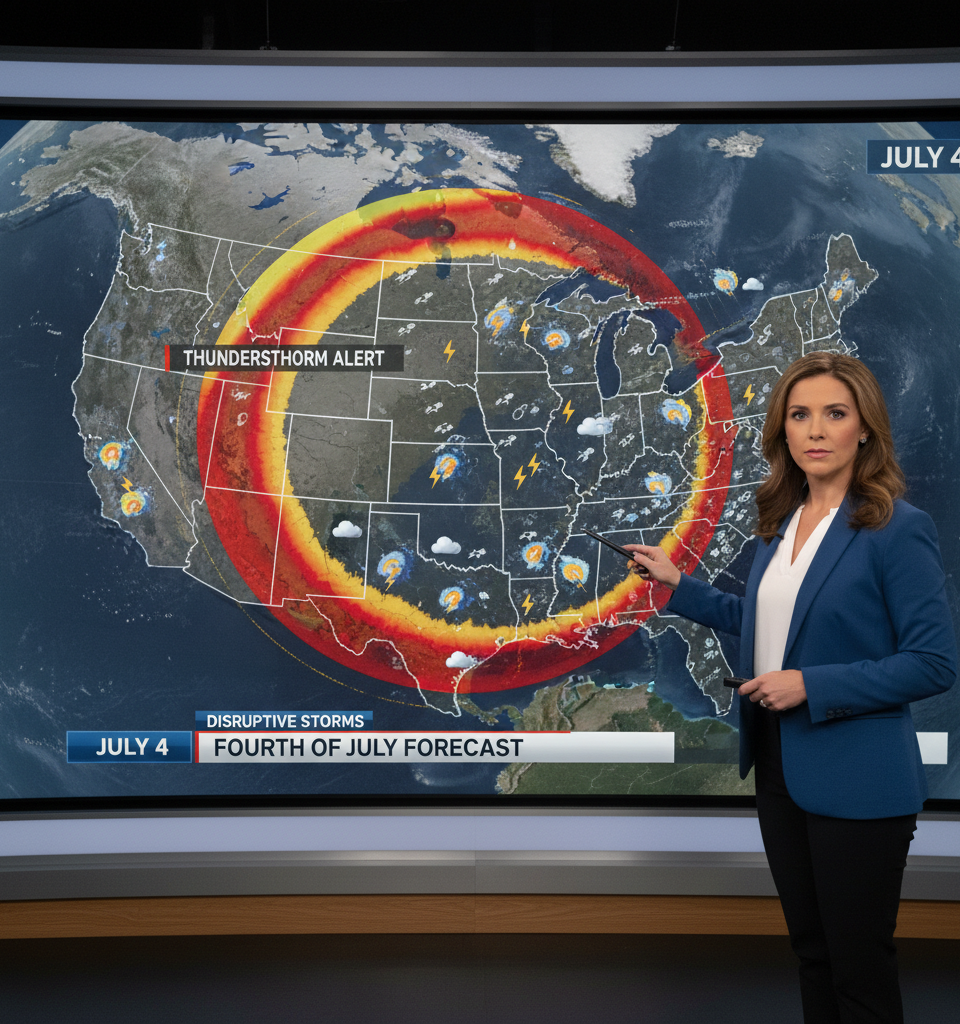
As the United States gears up for its Independence Day celebrations, weather forecasters are closely monitoring a developing "ring of fire" weather pattern that could usher in a series of disruptive thunderstorms across several parts of the country. This meteorological setup, characterized by a persistent ridge of high pressure, risks impacting outdoor festivities, including the traditional Fourth of July fireworks displays.
The 'Ring of Fire' Phenomenon
The "ring of fire" weather pattern typically develops when a strong dome of high pressure, often associated with intense heat, settles over a region. Around the periphery of this high-pressure system, particularly along its northern and western flanks, atmospheric instability can surge, creating a favorable environment for convection and severe weather. This phenomenon earned its name due to the arc-like formation of storms that tends to encircle the high-pressure core. For this year's holiday, affected areas could experience isolated to scattered thunderstorms, some of which may become severe, bringing heavy rainfall, lightning, and strong winds.
Potential Impact on Holiday Plans
The timing of this weather pattern is particularly critical as millions of Americans plan to gather for parades, barbecues, and fireworks. Disruptions could range from minor inconveniences, such as delays or cancellations of outdoor events, to more significant concerns like flash flooding in susceptible areas or lightning strikes posing a threat to public safety. Local authorities and event organizers are expected to monitor the forecasts closely and advise residents on necessary precautions or schedule adjustments.
Regional Forecasts Under Scrutiny
While specific regions most vulnerable to these thunderstorms are still being pinpointed with higher certainty as the holiday approaches, meteorologists indicate that areas situated along the rim of the anticipated high-pressure system will be on alert. Historically, such patterns have often affected parts of the Midwest, certain areas of the Plains, and occasionally extend into portions of the East Coast or the Ohio Valley, depending on the precise positioning and strength of the high-pressure dome. Residents in these regions are encouraged to have alternative plans for their outdoor celebrations and stay informed about local weather advisories.
Preparing for Potential Disruptions
Public safety officials emphasize the importance of preparedness. For those planning outdoor activities, having access to real-time weather alerts via smartphone applications or local news channels will be crucial. Families are advised to identify safe indoor shelters in case thunderstorms develop rapidly. Additionally, for organizers of large-scale fireworks displays, decisions regarding postponement or cancellation will likely hinge on the immediate proximity and severity of approaching storms, prioritizing the safety of spectators and operational crews.
Looking Ahead: Post-Holiday Outlook
The "ring of fire" pattern often signifies a prolonged period of elevated temperatures within the high-pressure core, while the stormy periphery can continue to be active for several days. Even after the Fourth of July, areas affected by the storm pattern may experience lingering instability, maintaining the risk of isolated inclement weather. The continued presence of this pattern could also influence air quality in some areas, particularly where heat and humidity persist, potentially leading to advisories for sensitive populations. Meteorologists will continue to track the system's evolution beyond the holiday weekend to assess its longer-term implications for summer weather across the country.